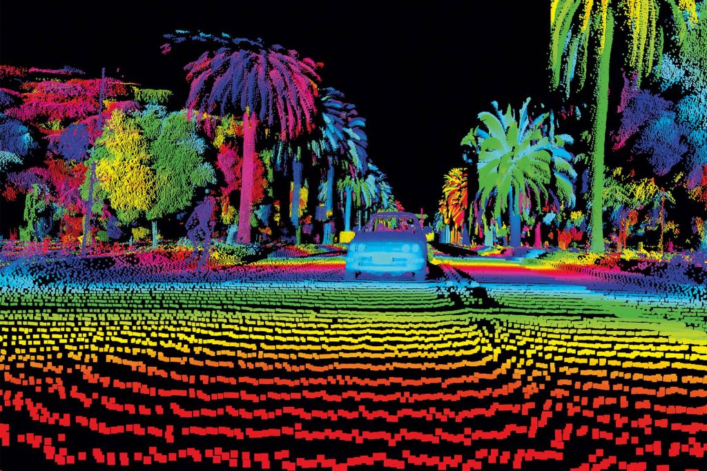
LiDAR, an acronym for Light Detection and Ranging, has quietly revolutionized how we perceive and interact with the world. From mapping vast terrains to guiding autonomous vehicles, this technology has become an indispensable tool across various industries.

How Does LiDAR Work?
Imagine firing countless tiny laser beams at a target. Each beam bounces back, providing precise measurements of distance. LiDAR captures this information, creating a detailed 3D map of the environment. This process, similar to radar but using light, forms the foundation for countless applications.
Fun Facts About LiDAR
- Lidar’s Humble Beginnings: While modern LiDAR systems rely on lasers, the concept dates back to the 1930s when meteorologists used light pulses to measure cloud heights. Talk about a cloudy start to a groundbreaking technology!
- Seeing Through the Clouds: LiDAR can penetrate clouds and fog, making it an invaluable tool for weather forecasting and aviation.
- Underwater Exploration: LiDAR can also be used to map underwater terrains, revealing hidden worlds beneath the ocean’s surface.
- Archaeological Discoveries: This technology has helped uncover ancient ruins and artifacts that would have otherwise remained hidden.
- Forest Management: LiDAR is used to measure forest height, density, and even the types of trees in an area, aiding in forest management and conservation efforts.
- Self-Driving Cars: LiDAR is a crucial component in the development of autonomous vehicles, helping them perceive their surroundings and navigate safely.
History of LiDAR
Initially used for weather forecasting, its potential was quickly recognized. The development of lasers in the 1960s marked a significant leap forward, enabling more precise measurements. Today, LiDAR is a cornerstone of many industries.
The Future of LiDAR
As technology continues to advance, LiDAR’s capabilities will expand, leading to even more innovative applications. From exploring underwater worlds to mapping Historic Sites, the possibilities are endless.
