
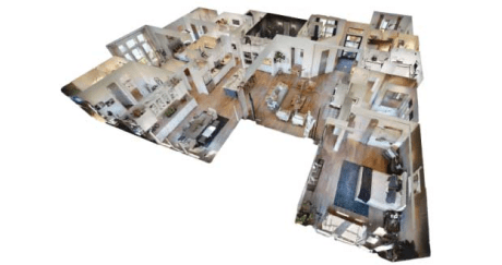
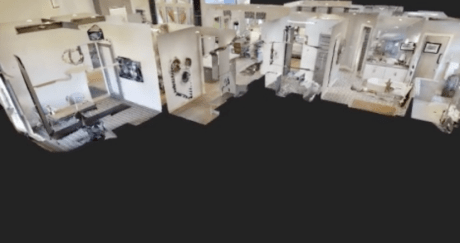
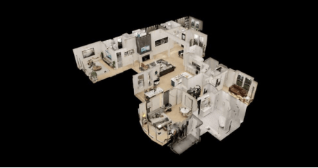
Matterport 3D Virtual Tours
Experience properties like never before with our Matterport 3D Virtual Tours. These immersive, high-quality tours provide a true-to-life view of spaces, allowing you to explore every detail from the comfort of your own home or office.
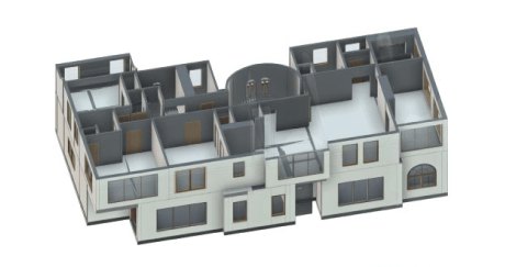
As-Built Plans and Services
Our As-Built Plans and Services ensure accurate and detailed documentation of your construction projects. We provide precise measurements and layouts, helping you capture the exact specifications of your completed buildings.
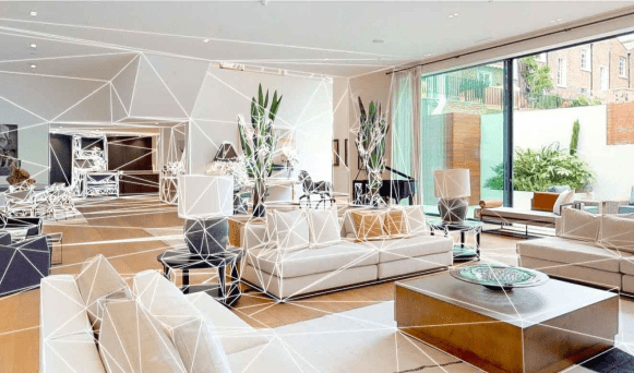
Digital Twins
Create a digital replica of your physical space with our Digital Twins service. This advanced technology allows for enhanced visualization and analysis, aiding in planning, maintenance, and future development.
3D CGI
Bring your projects to life with our 3D CGI (Computer-Generated Imagery) services. We create realistic and visually stunning renderings that showcase your designs in the most captivating way possible.
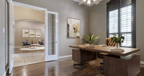
Virtual Staging in 2D and 3D
Enhance the appeal of your properties with our Virtual Staging services. Whether in 2D or 3D, we digitally furnish and decorate spaces to highlight their full potential, making them more attractive to potential buyers or tenants.
Aerial Photography & Mapping
Get a bird’s eye view of your projects with our Aerial Photography and Mapping services. Using the latest drone technology, we capture detailed aerial images and maps that provide valuable insights for planning and development.
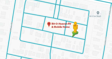
Google Maps Street View
Integrate your property into Google Maps with our Street View service. This feature enhances your online presence, making it easier for clients and customers to find and explore your location virtually.
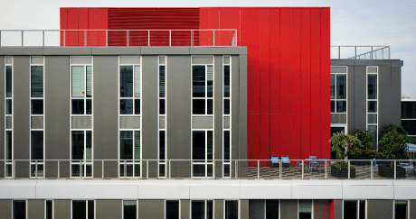
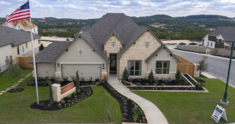
Professional Architectural Photography
Showcase your properties in the best light with our Architectural Photography services. Our expert photographers capture stunning images that highlight the unique features and beauty of your buildings.